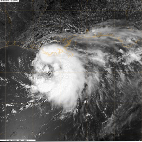
20080804.1702.terra.x.visqkm.05LEDOUARD.45kts-1002mb-281N-892W.100pc, originally uploaded by CoreBurn.


On 6th October 2007 typhoon Krosa slammed Taiwan with winds of up to 150mph.
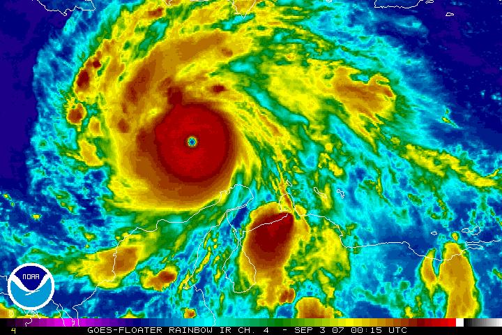
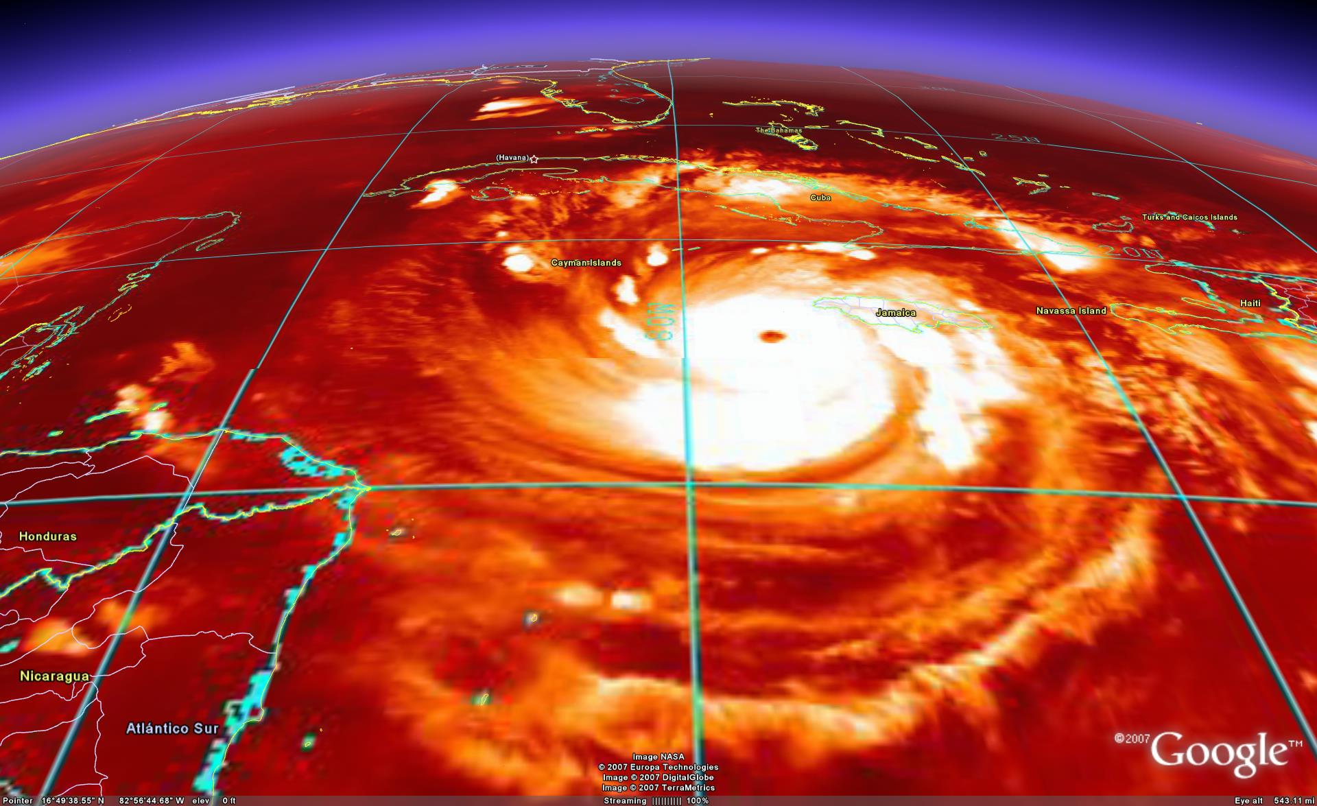
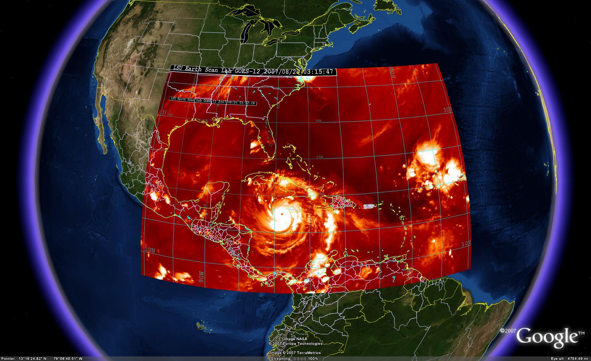
 Hurricane Felix - At Category 5

 Hurricane chasing blog will be covering a current ongoing chase intercept expedition of major Hurricane Dean on the Island of Jamaica. Hurricane Chaser Jim Edds is on location in Kingston, Jamaica for the landfall of this strong category 4 hurricane on Sunday. This site will be updating with pictures and video throughout the event.


 Hurricane Dean
 HONOLULU - Hurricane Flossie strengthened to a Category 4 storm Saturday as it spun more than 1,000 miles south of Hawaii.